The Eyes in the Sky How Zorvex Integrates Satellite and Drone Technology
In the quest for a more intelligent and efficient agricultural system, the ground-level view, while essential, tells only part of the story. To truly understand the intricate dynamics of a farm, we must look to the skies. Zorvex, a pioneer in precision agriculture, is doing just that by integrating cutting-edge satellite and drone technology into its FarmGenius platform. These “eyes in the sky” provide an unprecedented perspective, enabling farmers to monitor their crops, manage their resources, and make decisions with a level of accuracy that was once the stuff of science fiction.
Satellite technology has long been used in agriculture, but Zorvex is taking it to a new level. By leveraging high-resolution satellite imagery, the FarmGenius platform can provide a macro-level view of the entire farm. This allows for the analysis of large-scale patterns, such as variations in crop growth across different fields or the impact of topography on water distribution. The platform can also access historical satellite data, providing valuable insights into long-term trends and helping farmers to make more informed decisions about crop rotation and land management.
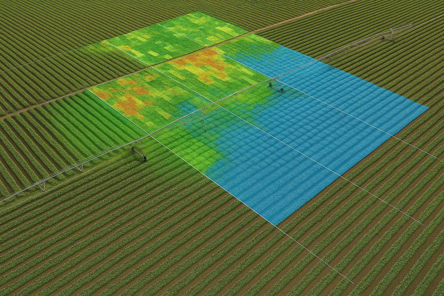
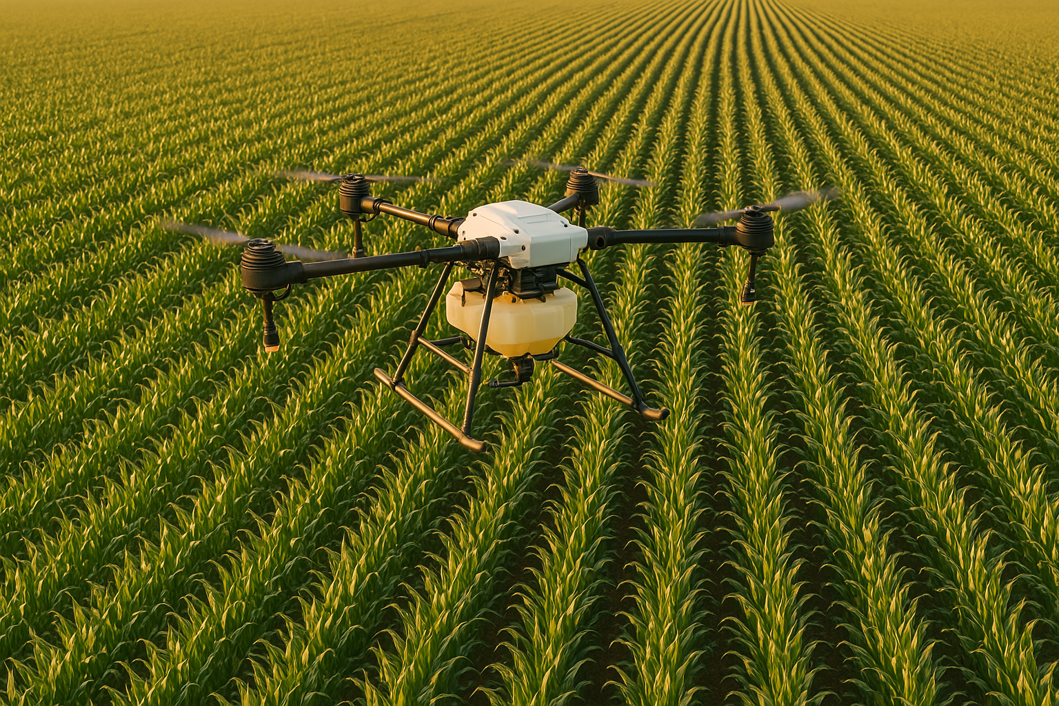
While satellites provide the big picture, drones offer a more detailed and on-demand view. Zorvex’s platform can seamlessly integrate with agricultural drones, which can be deployed to capture high-resolution imagery of specific areas of the farm. This is particularly useful for tasks such as early pest and disease detection, where a close-up view is essential. Drones can also be equipped with a variety of sensors, such as multispectral and thermal cameras, which can provide even more detailed information about crop health and stress levels.
The combination of satellite and drone technology is a powerful one. The satellites provide the broad context, while the drones offer the granular detail. This multi-layered approach allows farmers to have a comprehensive and up-to-the-minute understanding of their operations. For example, a satellite image might reveal an area of a field where crop growth is lagging. A drone can then be dispatched to that specific area to investigate further, providing the detailed information needed to diagnose the problem and take corrective action.
The data collected by satellites and drones is fed into the FarmGenius platform, where it is integrated with data from ground-based sensors. This creates a holistic and multi-dimensional model of the farm, providing a level of insight that is simply not possible with any single technology. The platform’s AI algorithms analyze this combined dataset to generate a wide range of outputs, from detailed crop health maps to precise recommendations for fertilization and irrigation.
The benefits of this integrated approach are numerous. By providing a more complete picture of the farm, Zorvex helps farmers to:
- Optimize resource use: By identifying areas of the farm that need more or less water, fertilizer, or other inputs, farmers can reduce waste and lower their costs.
- Improve crop yields: By detecting problems early and providing targeted interventions, farmers can improve crop health and maximize their yields.
- Enhance sustainability: By enabling more precise and efficient farming practices, Zorvex helps to reduce the environmental impact of agriculture.
Zorvex is not just providing technology; it is providing a new way of seeing the farm. By harnessing the power of the “eyes in the sky,” Zorvex is empowering farmers to manage their land with a level of precision and intelligence that was previously unimaginable. As we look to the future of agriculture, it is clear that the view from above will be more important than ever. And with Zorvex leading the way, that view is becoming clearer every day.